Southern Hemisphere Capitals by Coordinates
Written by Adi Ackerman, Head Teacher
"Southern Hemisphere Capitals by Coordinates" is written for 7th Grade (Ages 12-13). A 6th grader who is already steady on Map Skills and Coordinates can use it too, and an older student can use it as a short review.
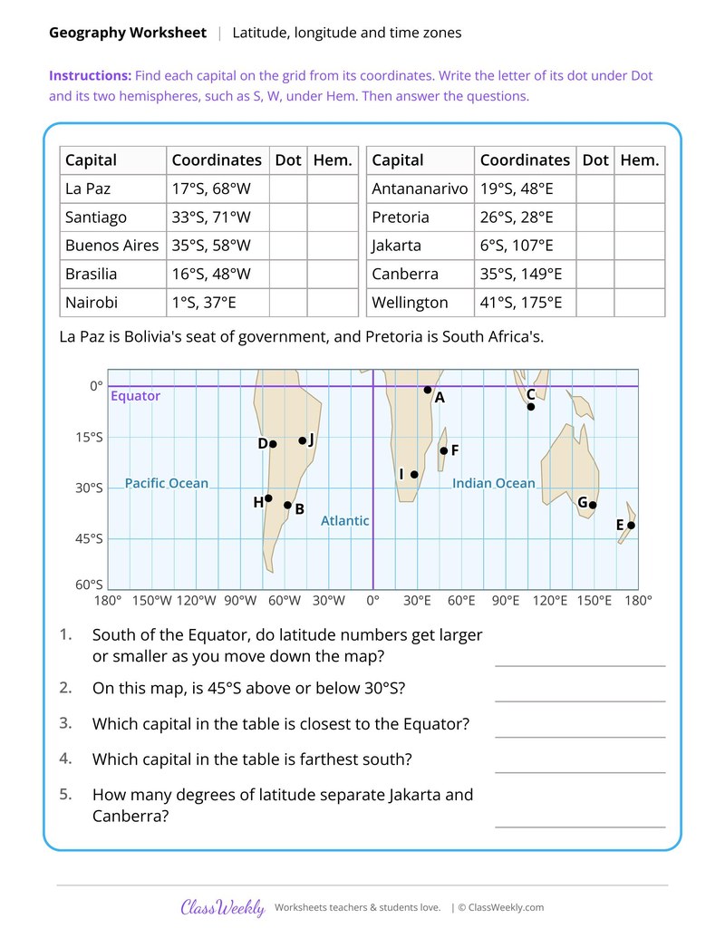
7th grade social studies worksheet: locate Southern Hemisphere capitals, from La Paz to Wellington, and name each one's hemispheres. Answer key included. Part of our latitude, longitude and time zones map skills and coordinates collection.
How do I use this worksheet?
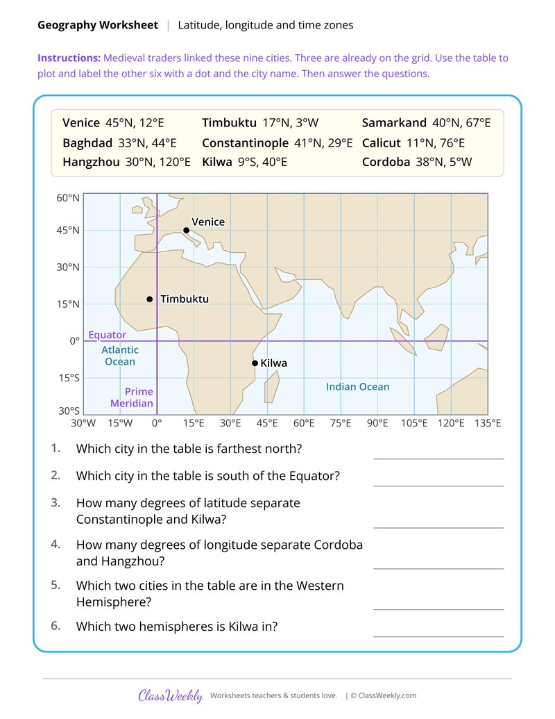
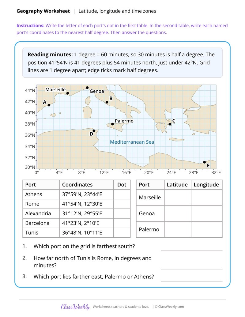
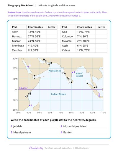
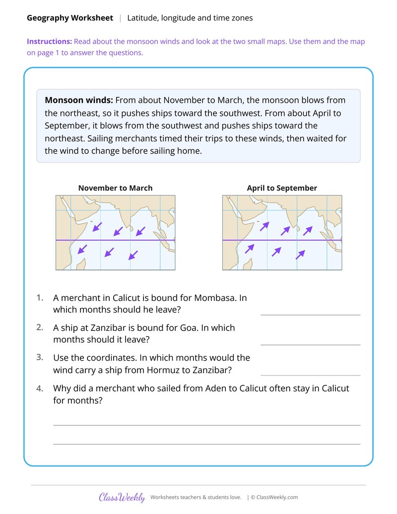
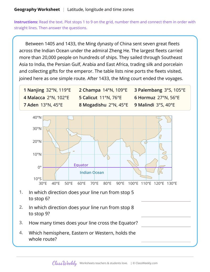
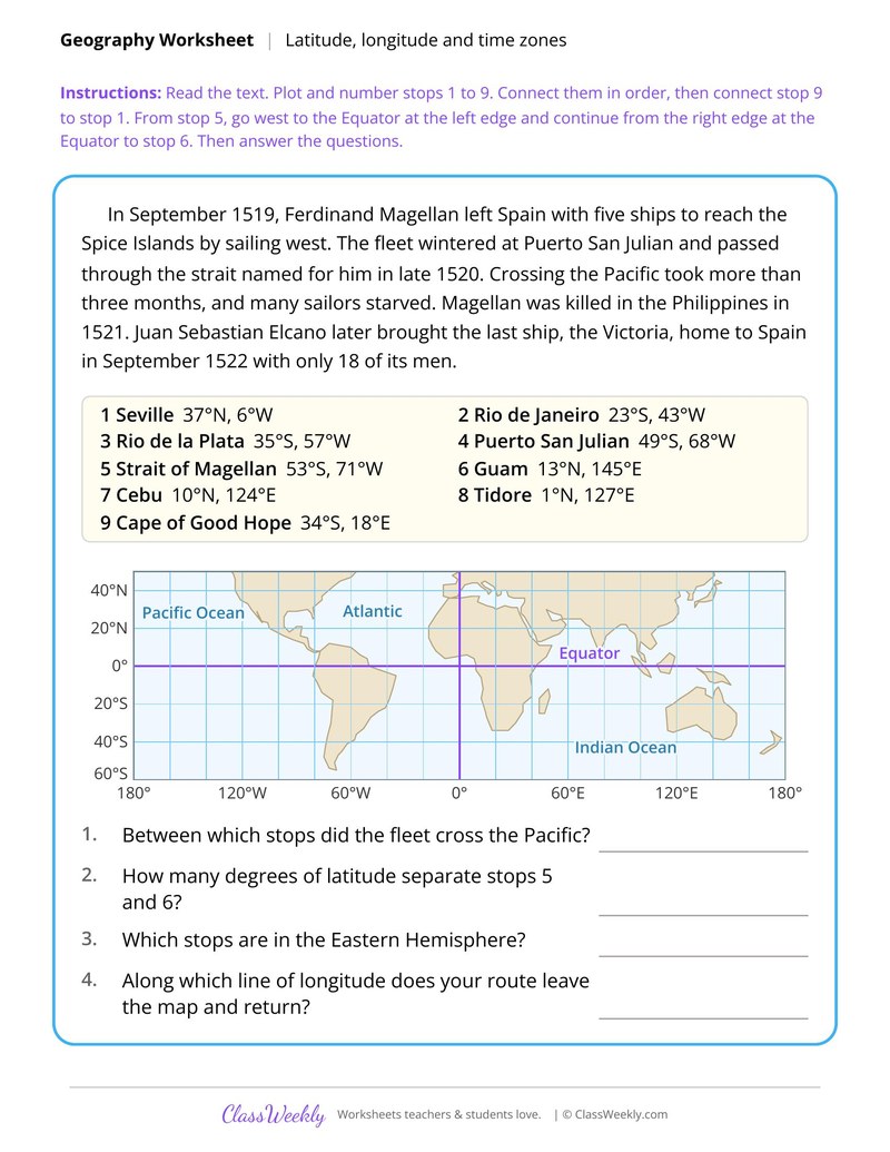
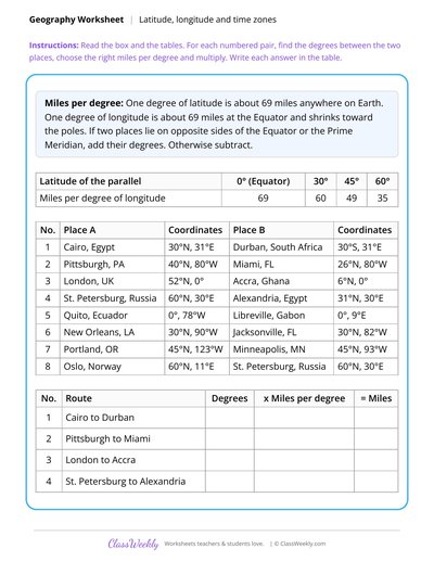
Start with Medieval Trade Cities by Latitude and Longitude, then use the minutes sheet before the route sheets. Save the distance sheet for last because it needs the others.
What students will practice
- Students will plot capitals from coordinates south of the Equator.
- Students will name the two hemispheres each capital lies in.
- Students will compare capitals by distance from the Equator and by degrees.
Curriculum Links
Find this in the curriculum
Browse the grade, subject, and topic this belongs to.
FAQ
How do I use this latitude, longitude and time zones worksheet?
⌄
Start with Medieval Trade Cities by Latitude and Longitude, then use the minutes sheet before the route sheets. Save the distance sheet for last because it needs the others.
What does this worksheet teach?
⌄
Locate Southern Hemisphere capitals, from La Paz to Wellington, and name each one's hemispheres. The directions on the page read: Find each capital on the grid from its coordinates. Write the letter of its dot under Dot and its two hemispheres, such as S, W, under Hem. Then answer the questions. An answer key is included.
Can I use this latitude, longitude and time zones worksheet for homeschool or classroom?
⌄
Yes, both. We made it for 7th grade Map Skills and Coordinates, and it works the same at home or at school. At home, a student can work through it alone and then go over it with you, which shows quickly what is solid and what needs another look. In class it works as independent practice, homework or a warm-up, and you can print one copy or a full set.
What is the Prime Meridian?
⌄
It is the line of 0° longitude. Places east of it have an E in their coordinates and places west of it have a W.
How do you tell which hemispheres a place is in?
⌄
Look at the letters in its coordinates. N or S gives the Northern or Southern Hemisphere, and E or W gives the Eastern or Western. Kilwa at 9°S, 40°E is in the Southern and Eastern Hemispheres.
How long is a degree of longitude?
⌄
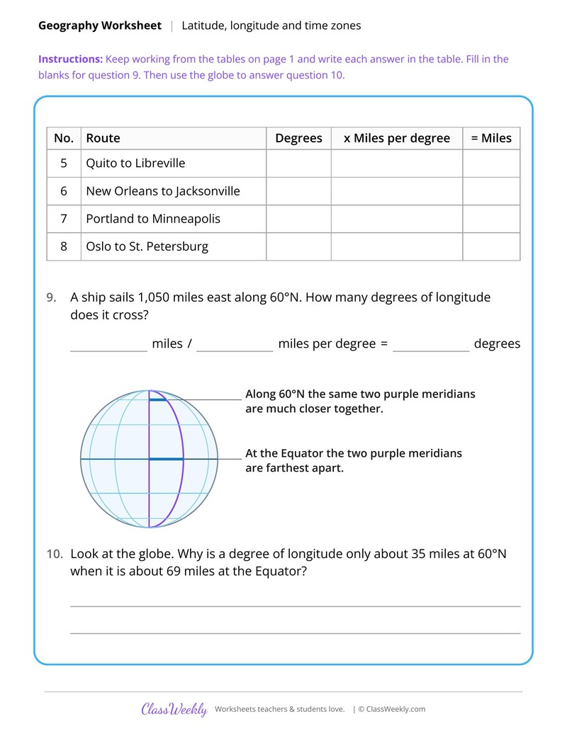
It is about 69 miles at the Equator and shrinks toward the poles, to about 35 miles at 60°N. Distance From Degrees of Latitude and Longitude shows the table.
Ratings & Reviews
No reviews yet. Be the first to share what you think.
Reviews are for ClassWeekly members.
Make a Request
Spotted something to fix, or want a worksheet we don't have yet? Tell us and we'll make it.
Worksheet Details
| Grade | 7th Grade |
| Subject | Social Studies |
| Topic | Map Skills and Coordinates |
| Pages | 1 page |
| Difficulty | Medium |
What is ClassWeekly?
ClassWeekly offers free worksheets and printable learning resources for kids, from preschool up. All worksheets are aligned to Common Core, NGSS, and C3 Framework standards and designed by educators. Become a member to access the full library and download unlimited PDFs.