Southern Colonies Economy Organizer
Written by Adi Ackerman, Head Teacher
"Southern Colonies Economy Organizer" is written for 7th Grade (Ages 12-13). A 6th grader who is already steady on The Thirteen Colonies can use it too, and an older student can use it as a short review.
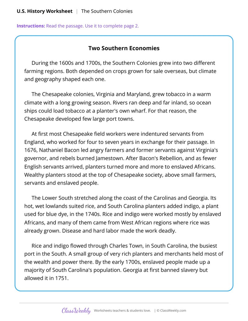
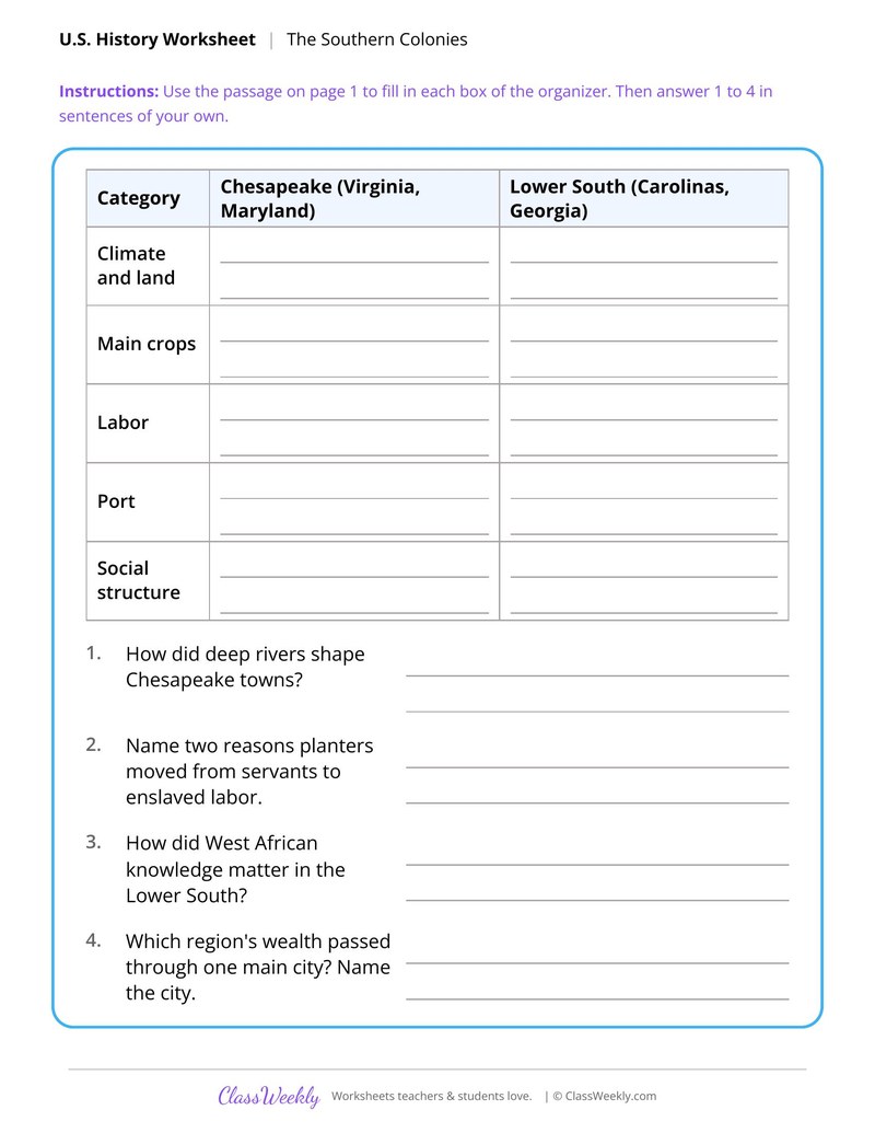
2 pages in this set
7th grade social studies worksheet: compare the Chesapeake and the Lower South by climate, crops, labor, ports and society. Answer key included. Part of our thirteen colonies by region collection.
How do I use this worksheet?
Use the map first so students know where each colony is, then read the regional comparison. The Southern economy organizer goes deeper on one region.
What students will practice
- Students will explain how climate and geography shaped two Southern farming regions.
- Students will fill an organizer comparing the Chesapeake and the Lower South.
- Students will explain how deep rivers shaped towns and why planters moved to enslaved labor.
Curriculum Links
Find this in the curriculum
Browse the grade, subject, and topic this belongs to.
FAQ
How do I use this thirteen colonies by region worksheet?
⌄
Use the map first so students know where each colony is, then read the regional comparison. The Southern economy organizer goes deeper on one region.
What does this worksheet teach?
⌄
Compare the Chesapeake and the Lower South by climate, crops, labor, ports and society. The directions on the page read: Read the passage. Use it to complete page 2. An answer key is included.
Can I use this thirteen colonies by region worksheet for homeschool or classroom?
⌄
Yes, both. We made it for 7th grade The Thirteen Colonies, and it works the same at home or at school. At home, a student can work through it alone and then go over it with you, which shows quickly what is solid and what needs another look. In class it works as independent practice, homework or a warm-up, and you can print one copy or a full set.
What are the three colonial regions?
⌄
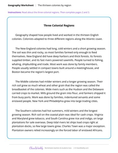
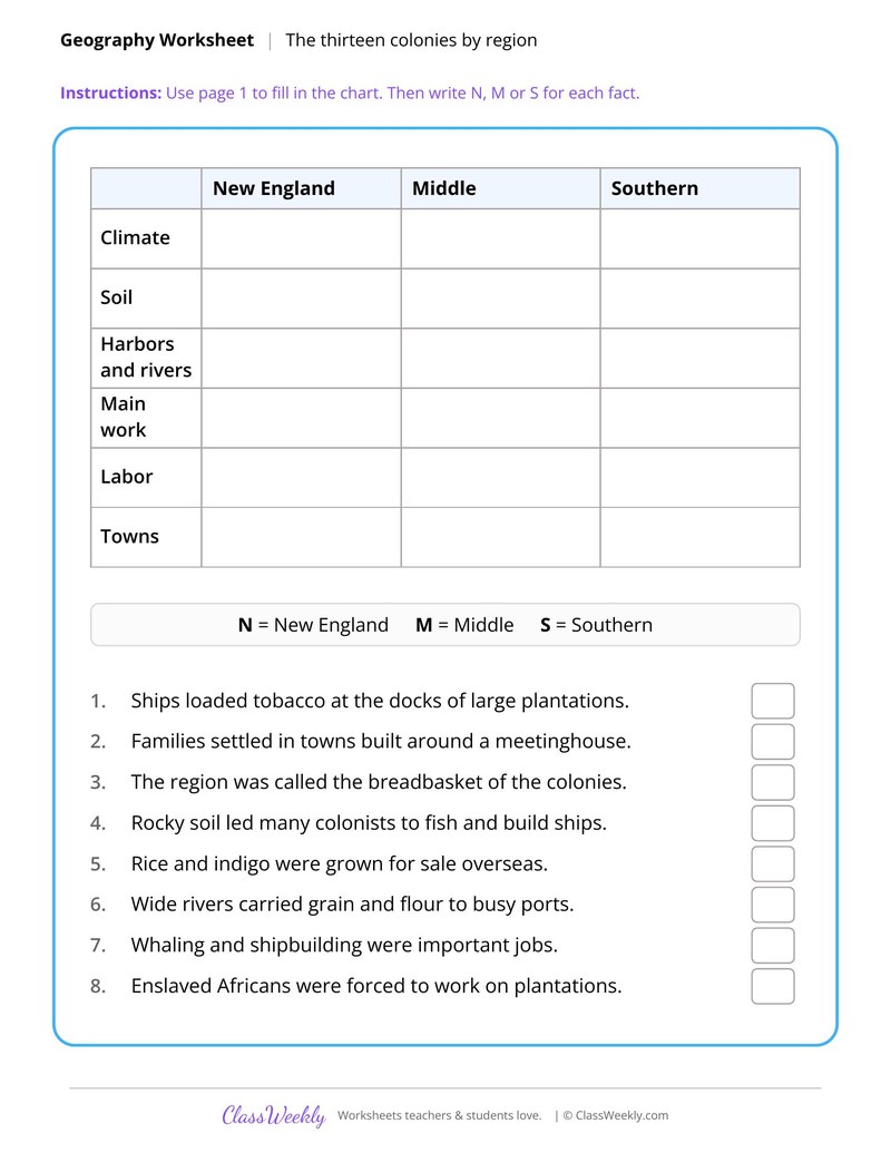
They are New England, the Middle colonies and the Southern colonies. The three page sheet compares them by climate, soil, harbors and rivers, main work, labor and towns.
How did geography shape life in the Southern colonies?
⌄
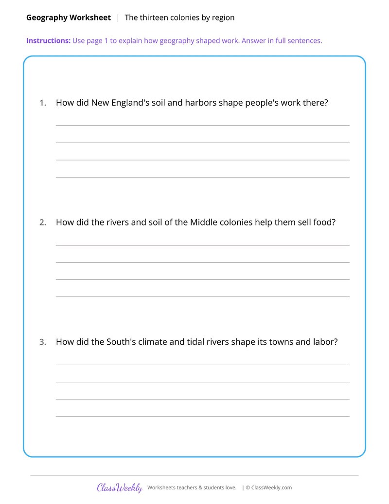
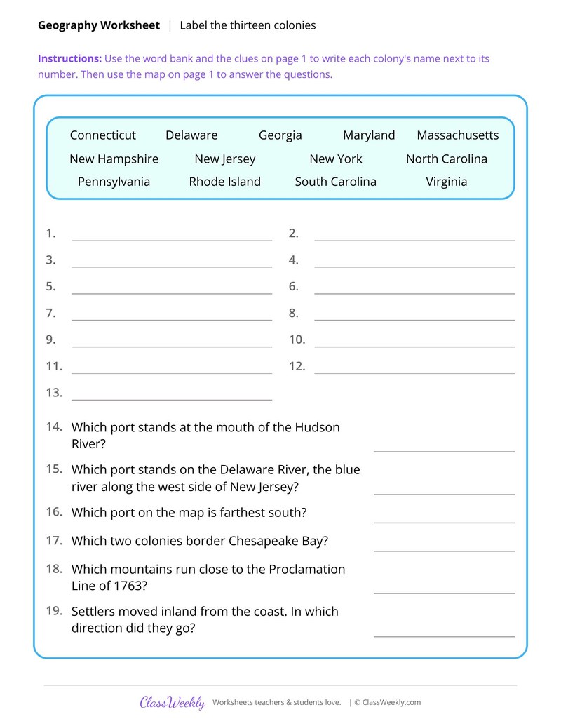
The Chesapeake grew tobacco in a warm climate, and deep rivers let ships load at a planter's own wharf. The Lower South developed a different economy with its own port. Students fill an organizer to compare them.
What is the Proclamation Line of 1763 on the map?
⌄
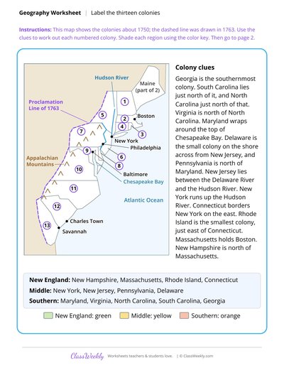
It is the dashed line on the map sheet that was drawn in 1763. Students use clues to name each numbered colony and shade each region with a color key.
Ratings & Reviews
No reviews yet. Be the first to share what you think.
Reviews are for ClassWeekly members.
Make a Request
Spotted something to fix, or want a worksheet we don't have yet? Tell us and we'll make it.
Worksheet Details
| Grade | 7th Grade |
| Subject | Social Studies |
| Topic | The Thirteen Colonies |
| Pages | 2 pages |
| Difficulty | Medium |
What is ClassWeekly?
ClassWeekly offers free worksheets and printable learning resources for kids, from preschool up. All worksheets are aligned to Common Core, NGSS, and C3 Framework standards and designed by educators. Become a member to access the full library and download unlimited PDFs.