Caribbean Islands by Size and Origin
Written by Adi Ackerman, Head Teacher
"Caribbean Islands by Size and Origin" is written for 7th Grade (Ages 12-13). A 6th grader who is already steady on World Geography and Regions can use it too, and an older student can use it as a short review.
2 pages in this set
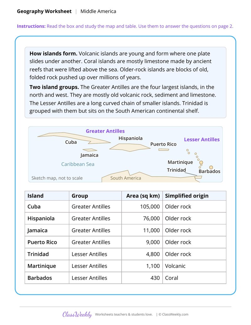
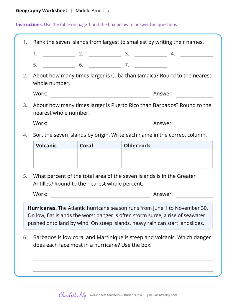
7th grade social studies worksheet: rank seven Caribbean islands by area, compare Cuba and Jamaica, and learn how islands form. Answer key included. Part of our Middle America world geography and regions collection.
How do I use this worksheet?
Begin with the physical map so students can place features, then use the other sheets by theme. The island sheet pairs well with a math lesson on ratios.
What students will practice
- Students will tell volcanic, coral and older rock islands apart.
- Students will rank seven islands from largest to smallest using a table.
- Students will compare island sizes with ratios rounded to a whole number.
Curriculum Links
Find this in the curriculum
Browse the grade, subject, and topic this belongs to.
FAQ
How do I use this Middle America worksheet?
⌄
Begin with the physical map so students can place features, then use the other sheets by theme. The island sheet pairs well with a math lesson on ratios.
What does this worksheet teach?
⌄
Rank seven Caribbean islands by area, compare Cuba and Jamaica, and learn how islands form. The directions on the page read: Read the box and study the map and table. Use them to answer the questions on page 2. An answer key is included.
Can I use this Middle America worksheet for homeschool or classroom?
⌄
Yes, both. We made it for 7th grade World Geography and Regions, and it works the same at home or at school. At home, a student can work through it alone and then go over it with you, which shows quickly what is solid and what needs another look. In class it works as independent practice, homework or a warm-up, and you can print one copy or a full set.
What are the elevation zones in Middle America?
⌄
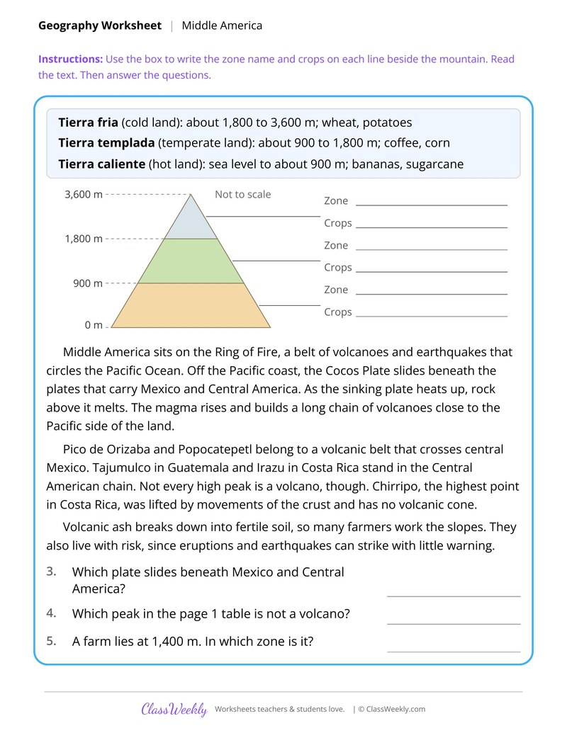
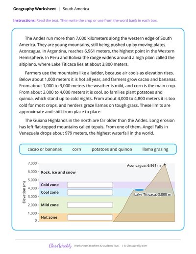
The sheet names tierra fria, tierra templada and tierra caliente. Tierra fria is about 1,800 to 3,600 meters with wheat and potatoes, templada is about 900 to 1,800 meters with coffee and corn, and caliente runs from sea level up.
Which peaks do students graph?
⌄
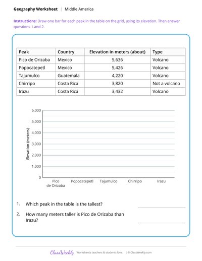
They graph Pico de Orizaba, Popocatepetl, Tajumulco, Chirripo and Irazu and note which are volcanoes. Elevations are given in meters.
How do Caribbean islands form?
⌄
The sheet says volcanic islands form where one plate slides under another, coral islands are mostly limestone made by ancient reefs, and older rock islands are folded blocks pushed up over millions of years.
Ratings & Reviews
No reviews yet. Be the first to share what you think.
Reviews are for ClassWeekly members.
Make a Request
Spotted something to fix, or want a worksheet we don't have yet? Tell us and we'll make it.
Worksheet Details
| Grade | 7th Grade |
| Subject | Social Studies |
| Topic | World Geography and Regions |
| Pages | 2 pages |
| Difficulty | Medium |
What is ClassWeekly?
ClassWeekly offers free worksheets and printable learning resources for kids, from preschool up. All worksheets are aligned to Common Core, NGSS, and C3 Framework standards and designed by educators. Become a member to access the full library and download unlimited PDFs.