Classify Air Masses From Station Data
Written by Adi Ackerman, Head Teacher
"Classify Air Masses From Station Data" is written for 7th Grade (Ages 12-13), and it covers NGSS MS-ESS2-5. A 6th grader who is already steady on Earth systems can use it too, and an older student can use it as a short review.
2 pages in this set
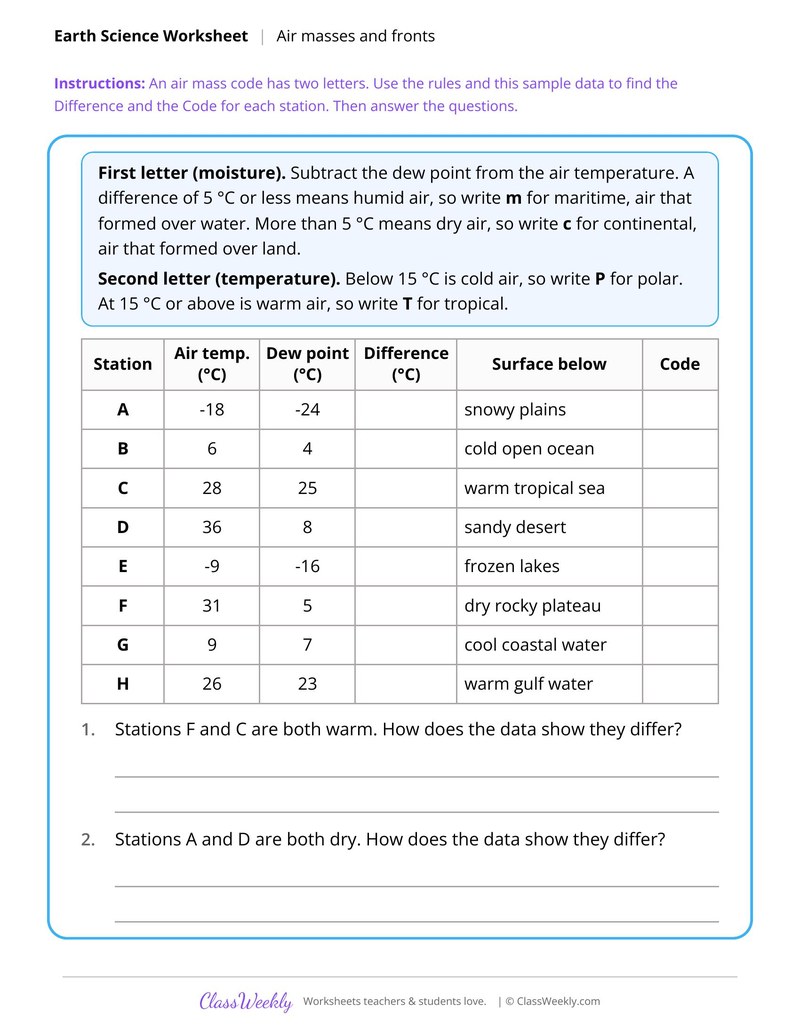
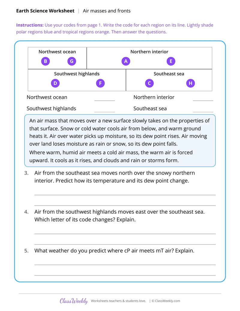
7th grade science worksheet: classify air masses with a two letter code from station data, then match codes to four regions. Answer key included. Part of our weather and climate earth systems collection. Aligned to NGSS standards.
How do I use this worksheet?
Use Energy and Gravity in the Water Cycle to set up the big ideas, then let students apply data skills on the hurricane and air mass sheets. The rules and tables on page 1 of each sheet are the reference for page 2.
What students will practice
- Students will subtract dew point from air temperature to decide whether an air mass is maritime or continental.
- Students will use temperature to decide whether an air mass is polar or tropical and write its code.
- Students will write codes for four regions on a map and shade polar and tropical regions.
Terrace Farming and Soil Loss
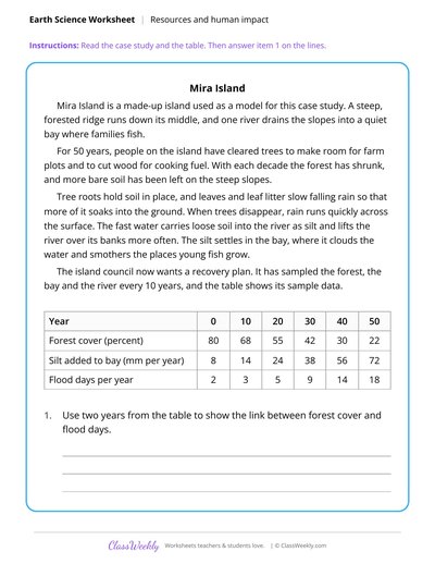
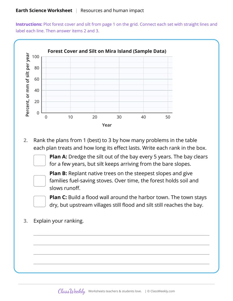
Case Study of a Deforested Island Watershed
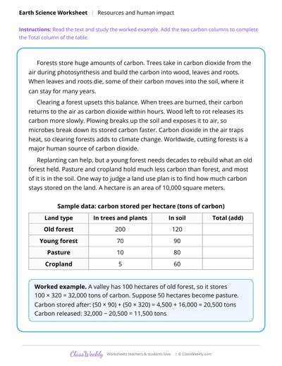
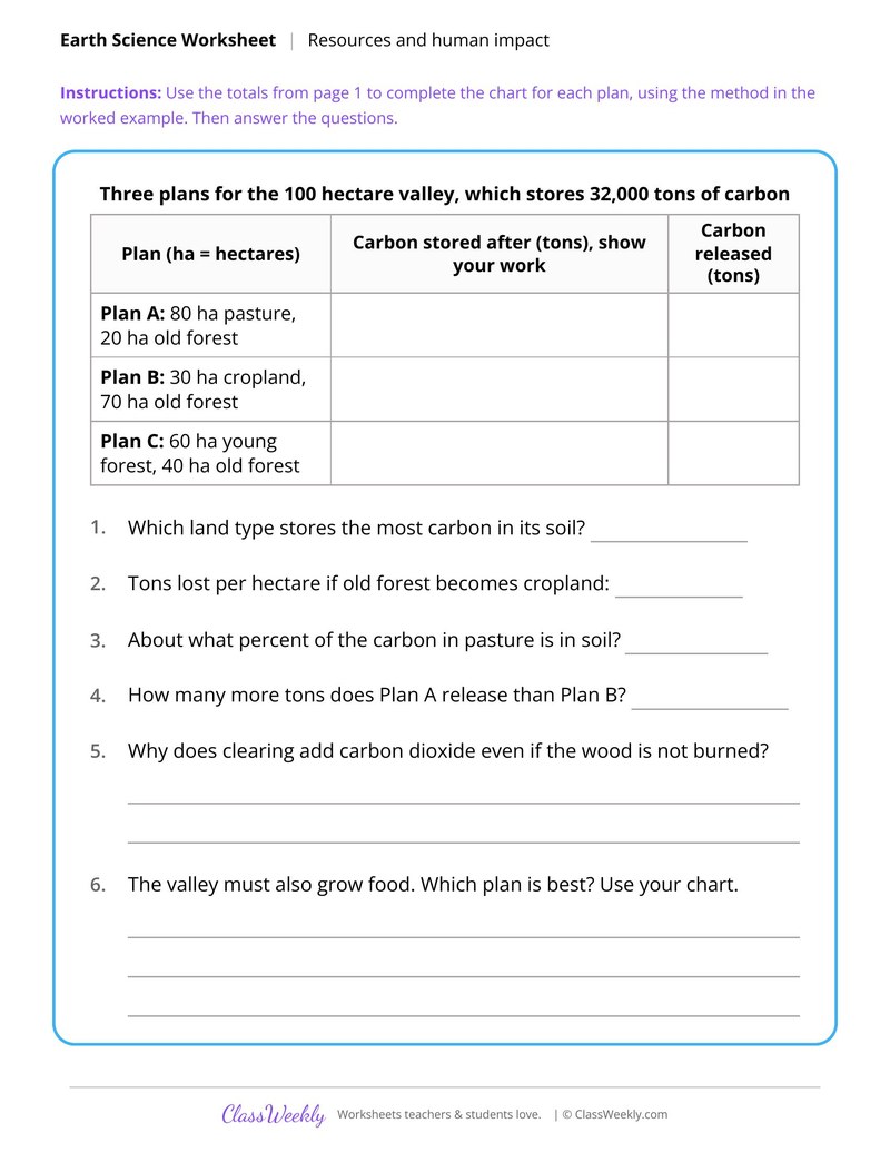
Deforestation and the Carbon Balance
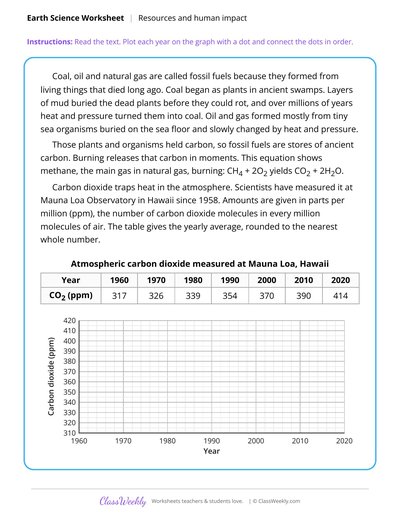
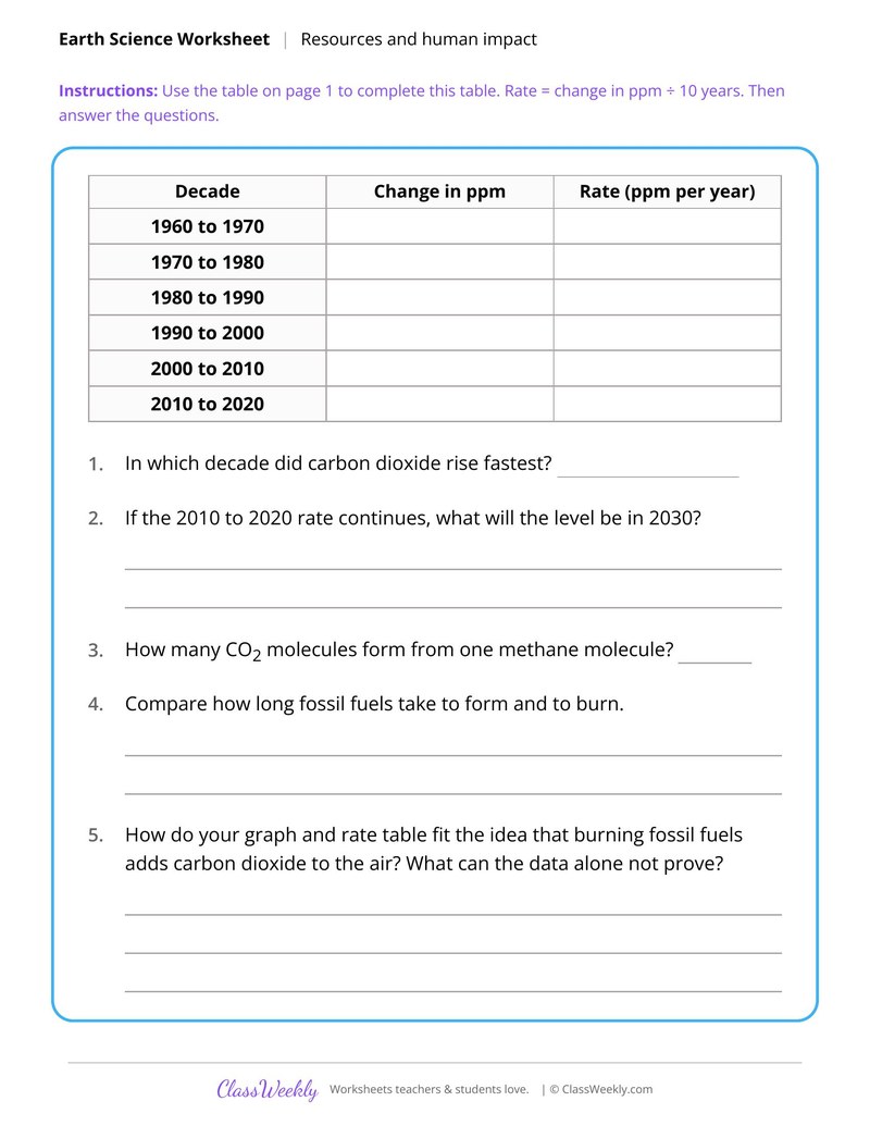
Fossil Fuel Formation and Carbon Dioxide Data
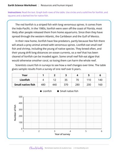
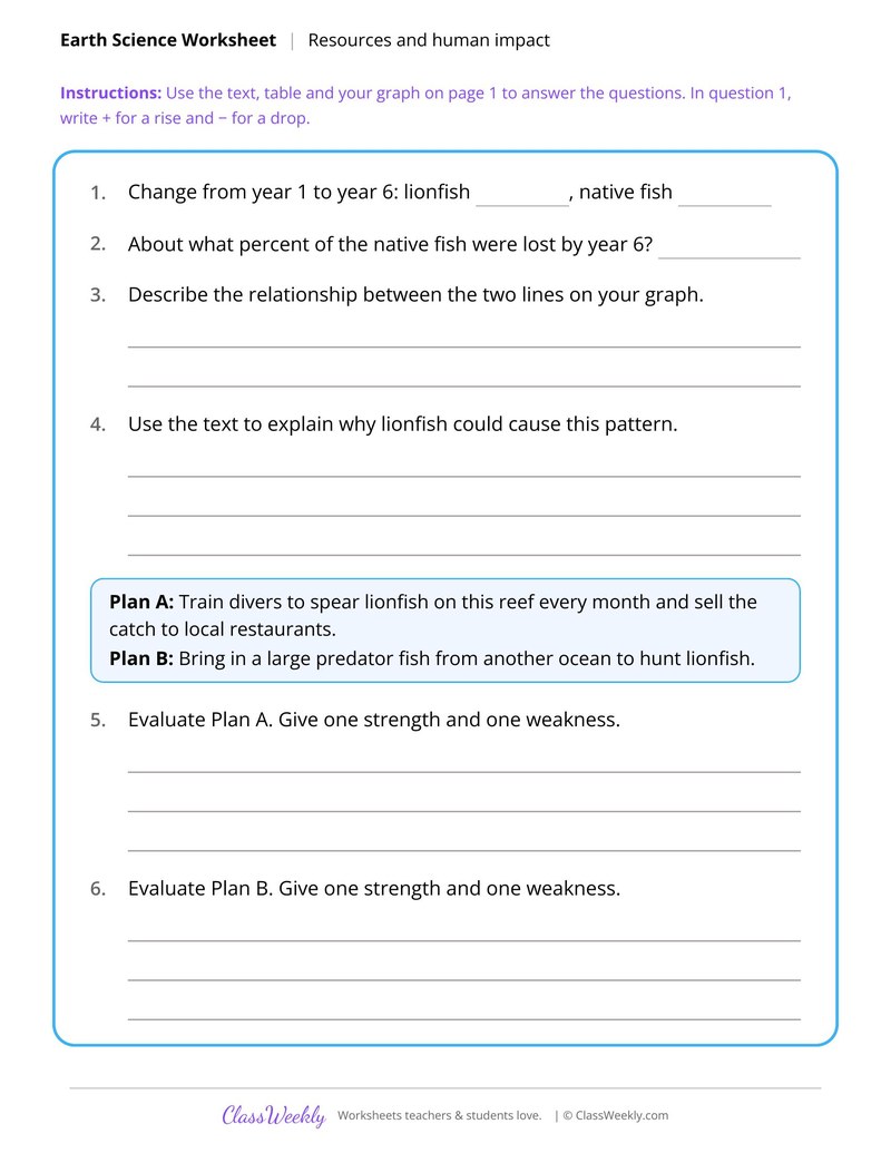
Lionfish Invasion Reef Survey Data
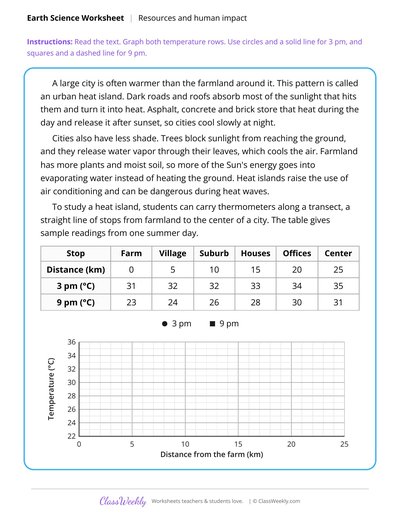
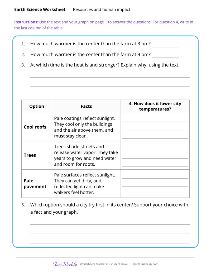
Urban Heat Island Data Analysis
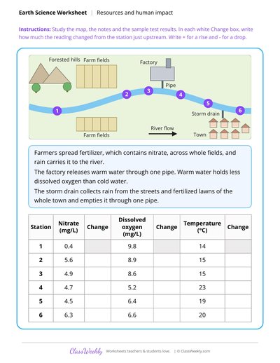
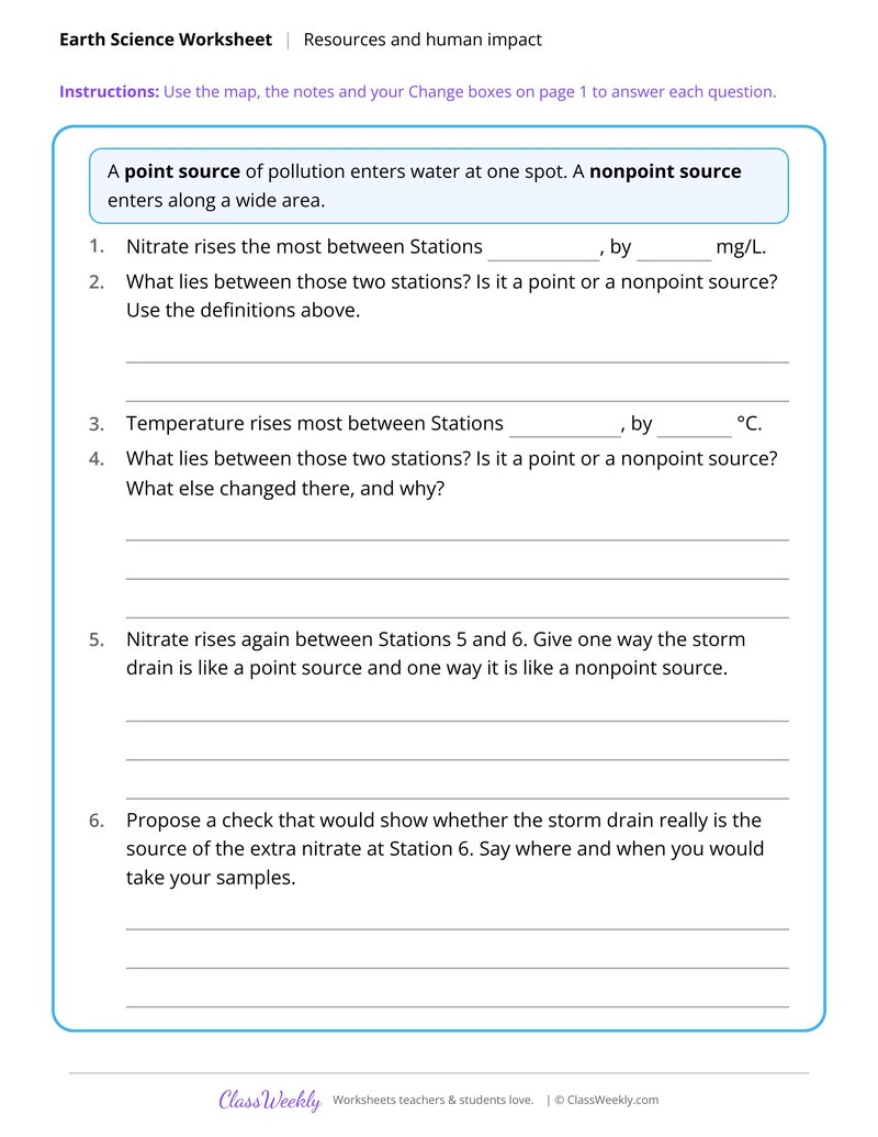
Find a Pollution Source With Water Test Data
Track a Hurricane and Forecast Its Path
Curriculum Links
Next Generation Science Standards
Science · 7th Grade
Find this in the curriculum
Browse the grade, subject, and topic this belongs to.
FAQ
How do I use this weather and climate worksheet?
⌄
Use Energy and Gravity in the Water Cycle to set up the big ideas, then let students apply data skills on the hurricane and air mass sheets. The rules and tables on page 1 of each sheet are the reference for page 2.
What does this worksheet teach?
⌄
Classify air masses with a two letter code from station data, then match codes to four regions. The directions on the page read: An air mass code has two letters. Use the rules and this sample data to find the Difference and the Code for each station. Then answer the questions. An answer key is included.
Can I use this weather and climate worksheet for homeschool or classroom?
⌄
Yes, both. We made it for 7th grade Earth systems, and it works the same at home or at school. At home, a student can work through it alone and then go over it with you, which shows quickly what is solid and what needs another look. In class it works as independent practice, homework or a warm-up, and you can print one copy or a full set.
How do you forecast the path of a hurricane?
⌄
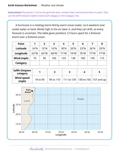
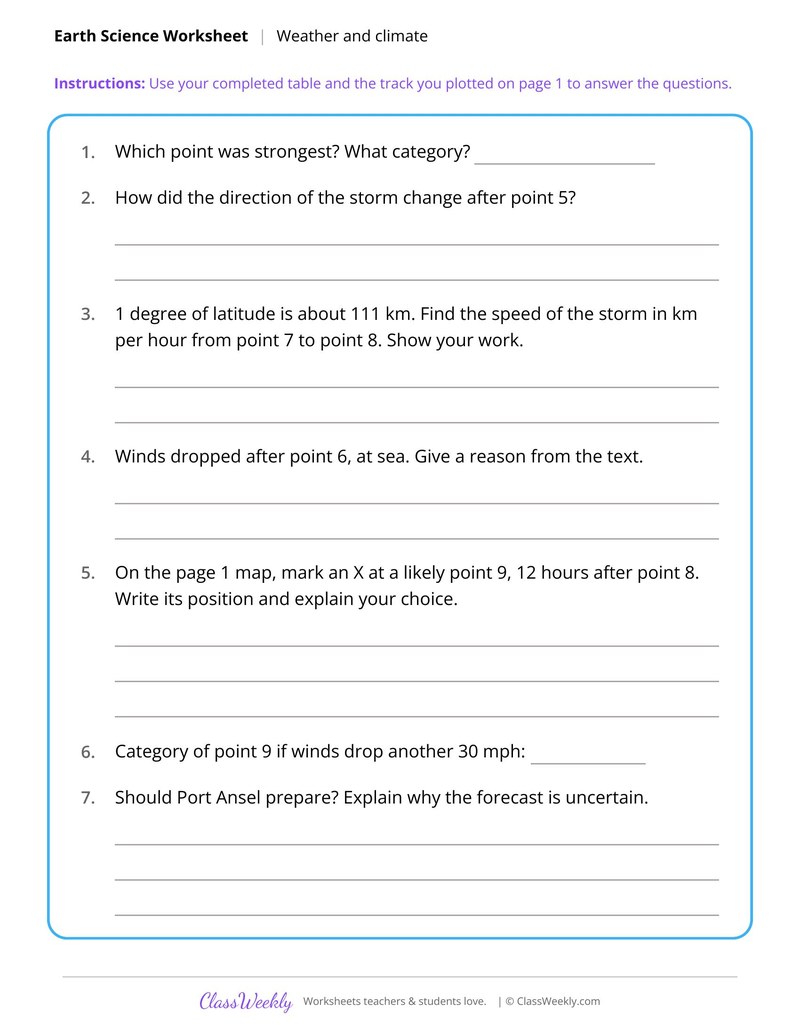
Plot the storm's positions on a grid and connect them in order to see its track. Winds high in the air steer a hurricane, and they can shift, so every forecast is uncertain. Track a Hurricane and Forecast Its Path uses a fictional storm over a fictional ocean.
What do the letters in an air mass code mean?
⌄
The first letter shows moisture, m for maritime or c for continental. The second shows temperature, P for polar or T for tropical. Classify Air Masses From Station Data gives the rules and sample data.
What drives the water cycle?
⌄
Energy from the Sun and the pull of gravity. Liquid water absorbs thermal energy and becomes vapor, and gravity moves water back down. Energy and Gravity in the Water Cycle has students mark each arrow A, R or G.
Ratings & Reviews
No reviews yet. Be the first to share what you think.
Reviews are for ClassWeekly members.
Make a Request
Spotted something to fix, or want a worksheet we don't have yet? Tell us and we'll make it.
Worksheet Details
| Grade | 7th Grade |
| Subject | Science |
| Topic | Earth Systems |
| Standard | MS-ESS2-5 |
| Pages | 2 pages |
| Difficulty | Medium |
What is ClassWeekly?
ClassWeekly offers free worksheets and printable learning resources for kids, from preschool up. All worksheets are aligned to Common Core, NGSS, and C3 Framework standards and designed by educators. Become a member to access the full library and download unlimited PDFs.
Terrace Farming and Soil Loss
Case Study of a Deforested Island Watershed
Deforestation and the Carbon Balance
Fossil Fuel Formation and Carbon Dioxide Data
Lionfish Invasion Reef Survey Data
Urban Heat Island Data Analysis
Find a Pollution Source With Water Test Data
Track a Hurricane and Forecast Its Path