Territorial Growth of the United States, 1783 to 1853
Written by Adi Ackerman, Head Teacher
"Territorial Growth of the United States, 1783 to 1853" is written for 8th Grade (Ages 13-14), and it covers C3 Framework D2.Geo.1.6-8. A 7th grader who is already steady on U.S. Regions and Landforms can use it too, and an older student can use it as a short review.
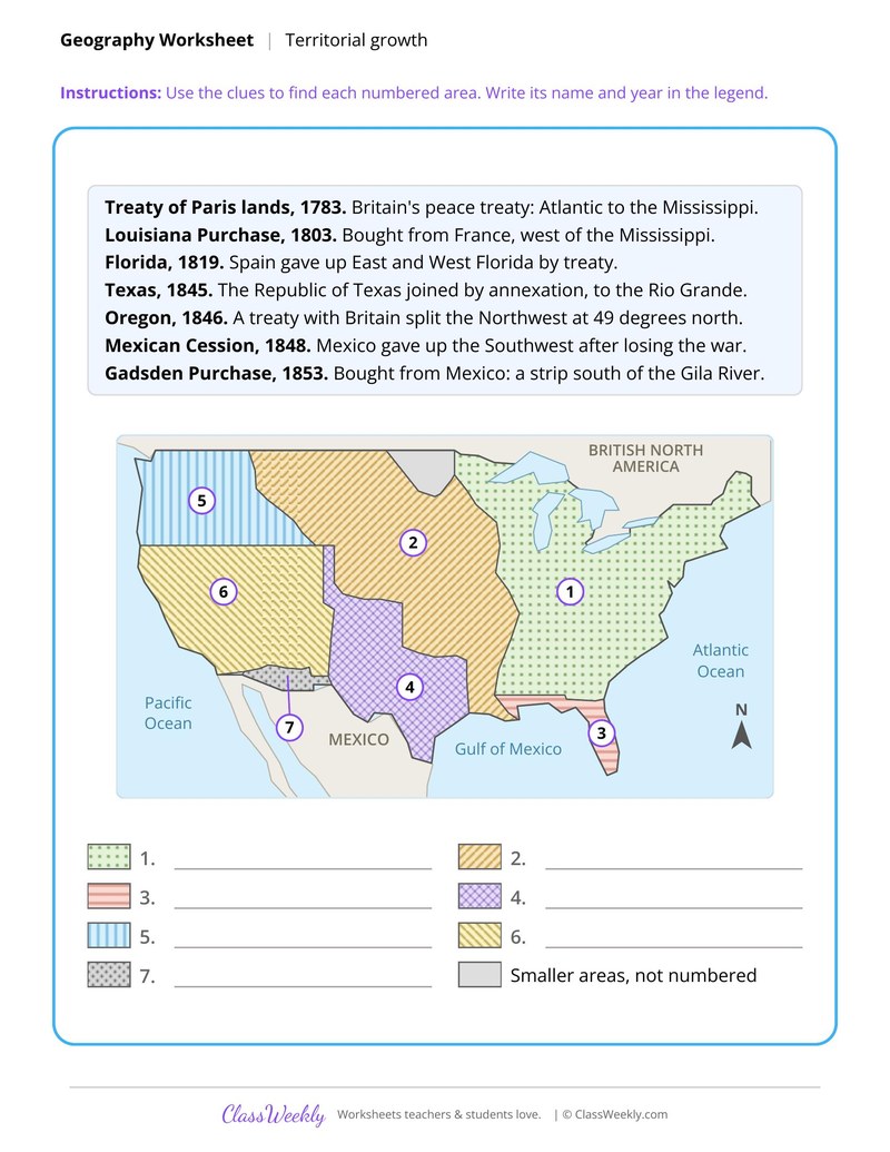
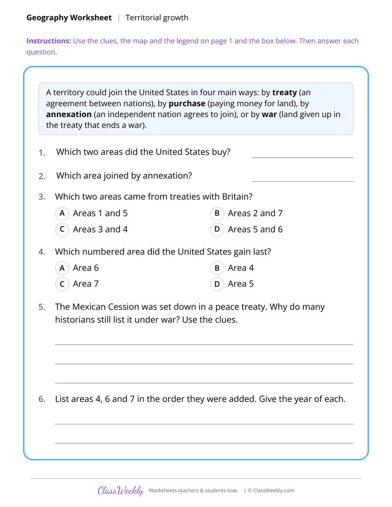
2 pages in this set
8th grade social studies worksheet: label seven land gains from 1783 to 1853 and sort them by treaty, purchase, annexation or war. Answer key included. Part of our regions and landforms collection. Aligned to C3 Framework standards.
How do I use this worksheet?
Start with the territorial growth map to frame the period, then move region by region. Pair each map sheet with a reading or graph sheet on the same area.
What students will practice
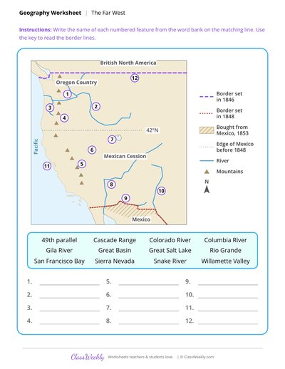
- Students will use clues to label seven areas and their years on a map legend.
- Students will sort each addition by treaty, purchase, annexation or war.
- Students will order the areas the United States gained from 1845 to 1853.
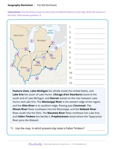
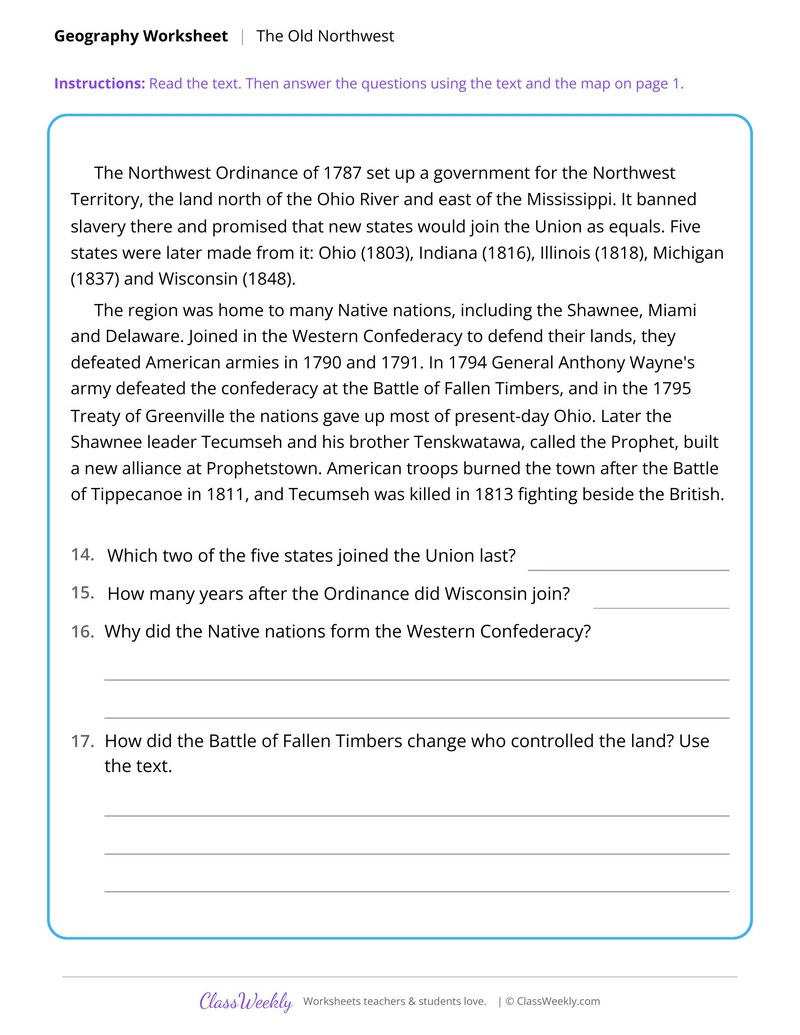
Curriculum Links
C3 Framework for Social Studies State Standards
Social Studies · 8th Grade
Find this in the curriculum
Browse the grade, subject, and topic this belongs to.
FAQ
How do I use this regions and landforms worksheet?
⌄
Start with the territorial growth map to frame the period, then move region by region. Pair each map sheet with a reading or graph sheet on the same area.
What does this worksheet teach?
⌄
Label seven land gains from 1783 to 1853 and sort them by treaty, purchase, annexation or war. The directions on the page read: Use the clues to find each numbered area. Write its name and year in the legend. An answer key is included.
Can I use this regions and landforms worksheet for homeschool or classroom?
⌄
Yes, both. We made it for 8th grade U.S. Regions and Landforms, and it works the same at home or at school. At home, a student can work through it alone and then go over it with you, which shows quickly what is solid and what needs another look. In class it works as independent practice, homework or a warm-up, and you can print one copy or a full set.
What was the Old Northwest?
⌄
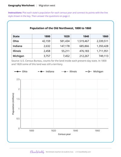
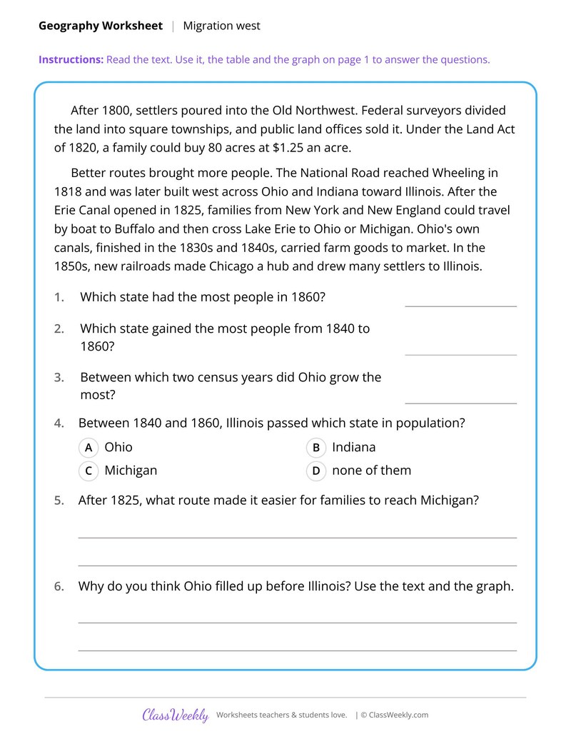
It was the land north of the Ohio River and east of the Mississippi, governed under the Northwest Ordinance of 1787. Ohio, Indiana, Illinois, Michigan and Wisconsin were later made from it.
What is the Black Belt?
⌄
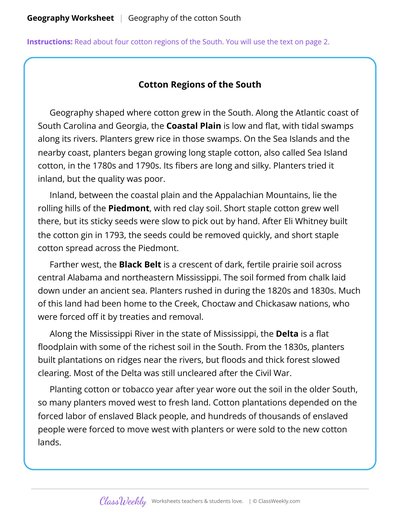
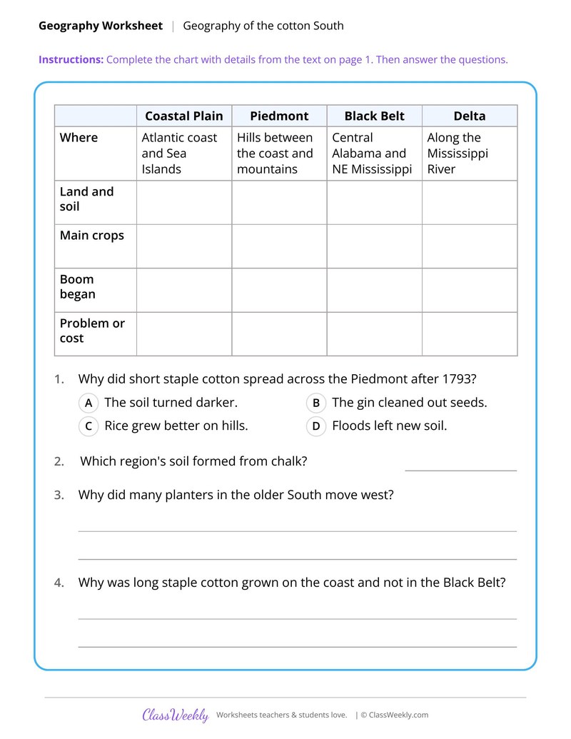
The Black Belt is a crescent of dark, fertile prairie soil across central Alabama and northeastern Mississippi. The soil formed from chalk, and it became a major cotton region.
Why did families go to the Willamette Valley?
⌄
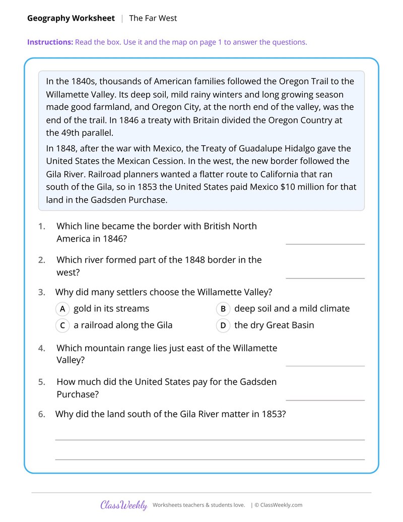
Its deep soil, mild rainy winters and long growing season made good farmland. Oregon City, at the north end of the valley, was the end of the Oregon Trail.
Ratings & Reviews
No reviews yet. Be the first to share what you think.
Reviews are for ClassWeekly members.
Make a Request
Spotted something to fix, or want a worksheet we don't have yet? Tell us and we'll make it.
Worksheet Details
| Grade | 8th Grade |
| Subject | Social Studies |
| Topic | U.S. Regions and Landforms |
| Standard | D2.Geo.1.6-8 |
| Pages | 2 pages |
| Difficulty | Medium |
What is ClassWeekly?
ClassWeekly offers free worksheets and printable learning resources for kids, from preschool up. All worksheets are aligned to Common Core, NGSS, and C3 Framework standards and designed by educators. Become a member to access the full library and download unlimited PDFs.