Mountain Passes of the West by Elevation
Written by Adi Ackerman, Head Teacher
"Mountain Passes of the West by Elevation" is written for 8th Grade (Ages 13-14), and it covers C3 Framework D2.Geo.2.6-8. A 7th grader who is already steady on Westward Expansion and Trails can use it too, and an older student can use it as a short review.
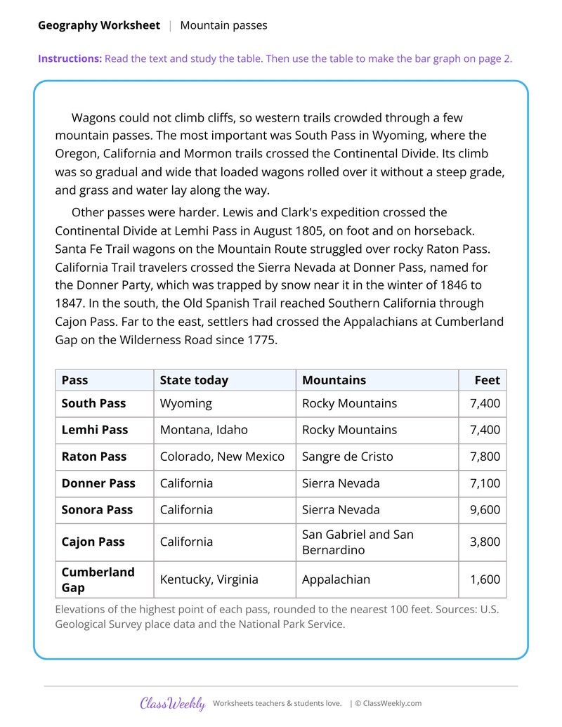
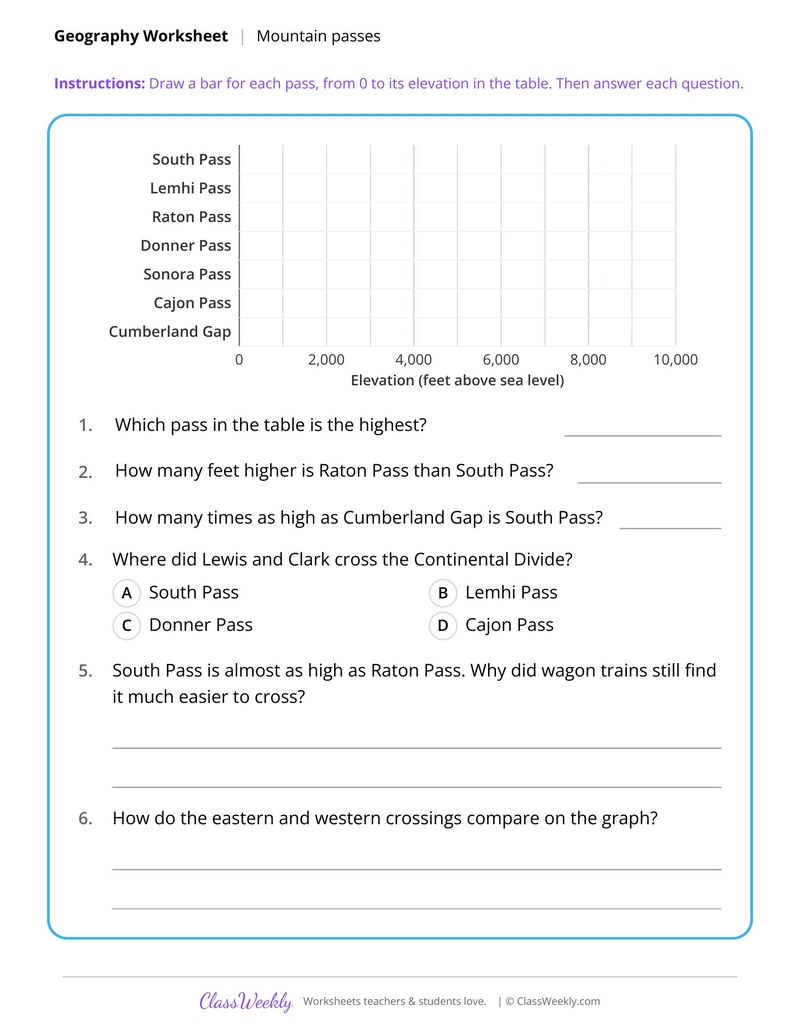
2 pages in this set
8th grade social studies worksheet: graph the elevations of seven western passes and explain why wagons used South Pass. Answer key included. Part of our expansion and trails collection. Aligned to C3 Framework standards.
How do I use this worksheet?
Use the National Road sheet to open the unit, then the timeline. The map scale and pass sheets work well as a pair because both ask why travelers chose one route over another.
What students will practice
- Students will draw a bar graph of the elevations of seven mountain passes.
- Students will compare elevations, such as Raton Pass and South Pass, with subtraction.
- Students will explain why wagon trains found South Pass easier to cross.
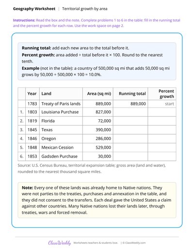
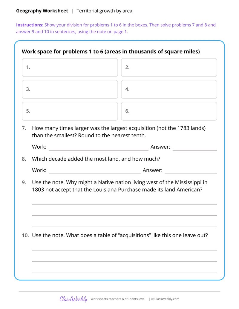
Area Math for U.S. Land Acquisitions
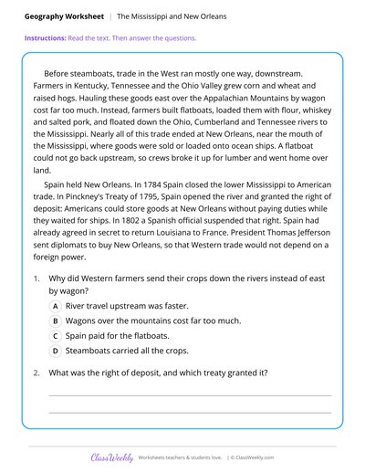
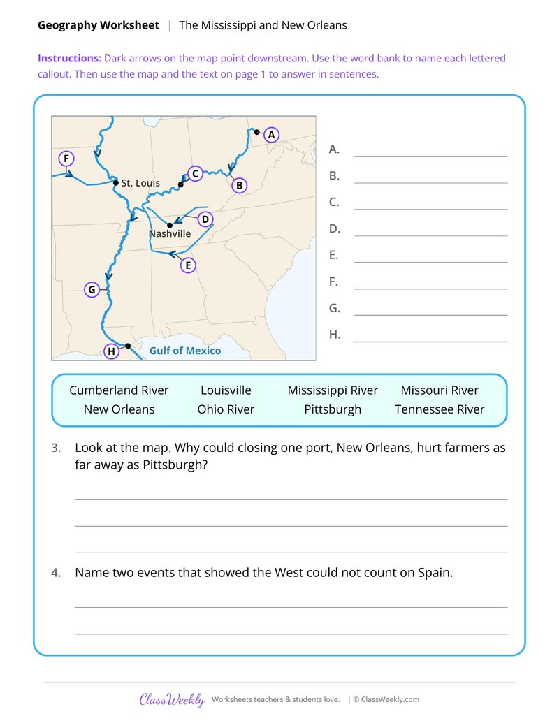
The Mississippi River as the Highway of the West
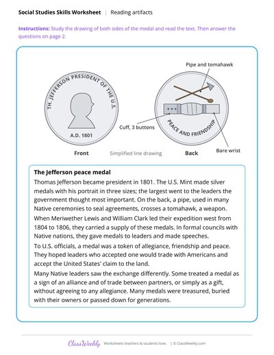
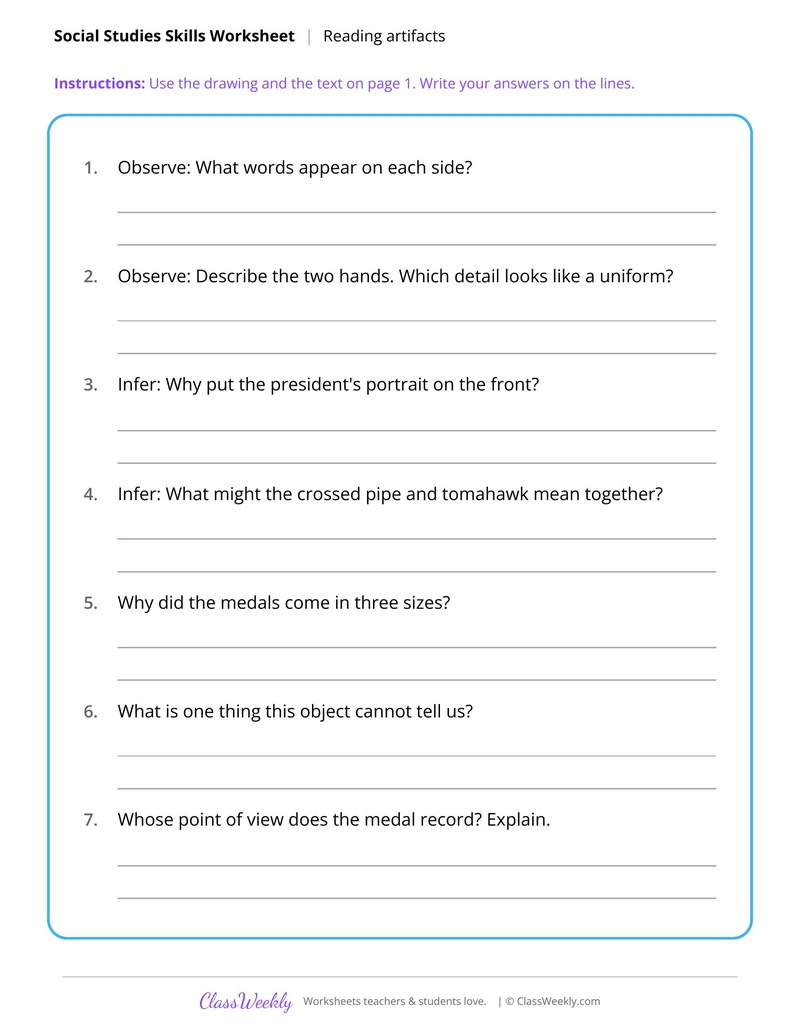
The Jefferson Peace Medal as Evidence
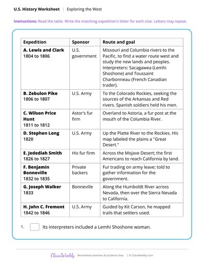
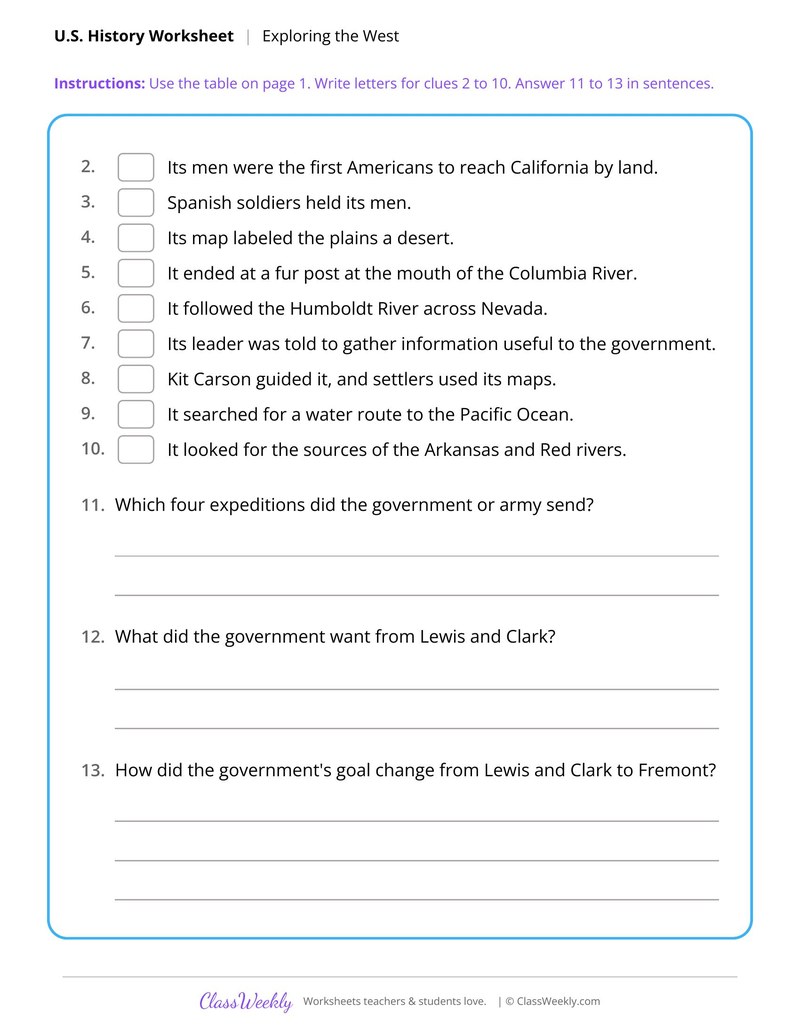
Explorers of the American West, 1804 to 1846
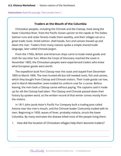
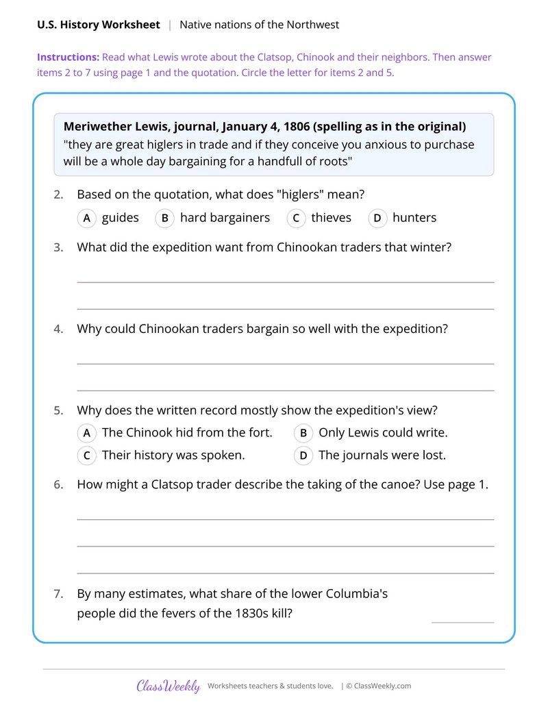
Chinook Traders and the Corps of Discovery
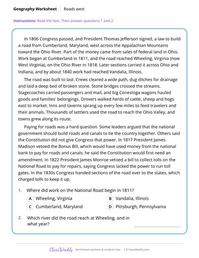
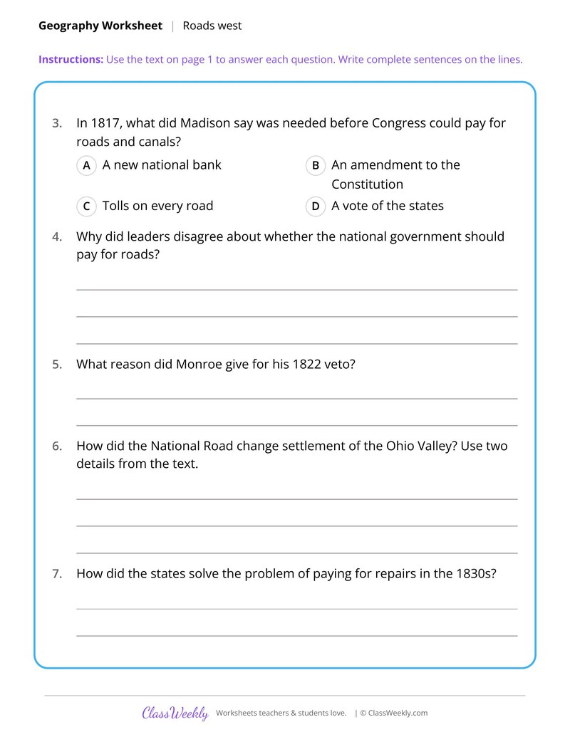
The National Road and the Way West
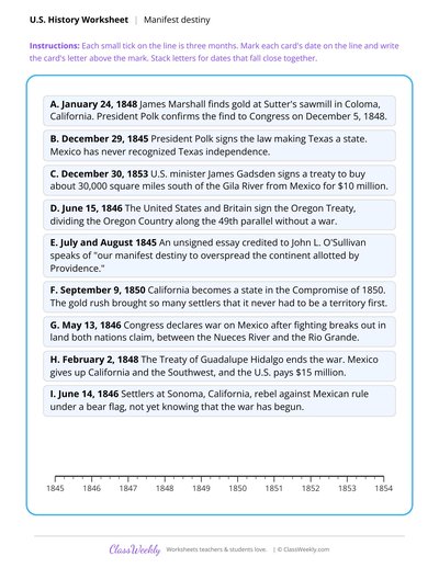
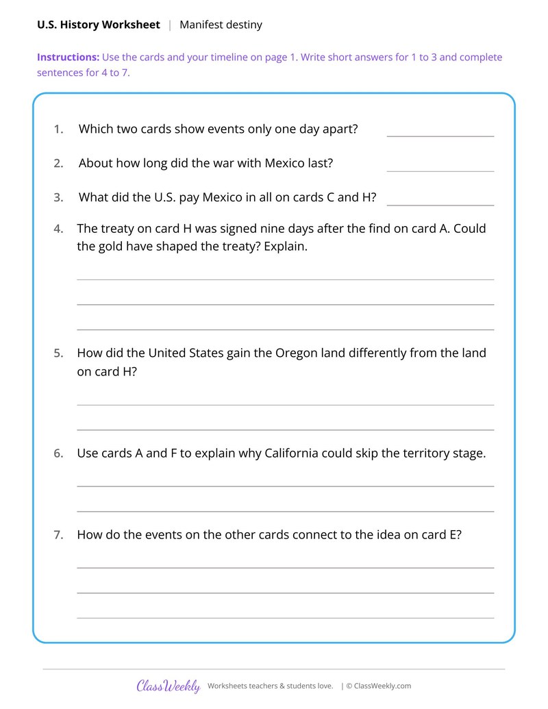
Manifest Destiny Timeline, 1845 to 1854
The Sierra Nevada Foothills and the Gold Rush
Curriculum Links
C3 Framework for Social Studies State Standards
Social Studies · 8th Grade
Find this in the curriculum
Browse the grade, subject, and topic this belongs to.
FAQ
How do I use this expansion and trails worksheet?
⌄
Use the National Road sheet to open the unit, then the timeline. The map scale and pass sheets work well as a pair because both ask why travelers chose one route over another.
What does this worksheet teach?
⌄
Graph the elevations of seven western passes and explain why wagons used South Pass. The directions on the page read: Read the text and study the table. Then use the table to make the bar graph on page 2. An answer key is included.
Can I use this expansion and trails worksheet for homeschool or classroom?
⌄
Yes, both. We made it for 8th grade Westward Expansion and Trails, and it works the same at home or at school. At home, a student can work through it alone and then go over it with you, which shows quickly what is solid and what needs another look. In class it works as independent practice, homework or a warm-up, and you can print one copy or a full set.
What was manifest destiny?
⌄
Manifest destiny was the idea that the United States should spread across the continent. The timeline sheet connects it to Texas statehood, the Oregon Treaty, the gold find at Coloma and the Gadsden treaty.
How long was the Santa Fe Trail?
⌄
Students find out themselves by measuring each leg on the map with a strip of paper and the scale. They add the legs for the Cimarron Route and the Mountain Route, which was about 50 miles longer.
Where did the Gold Rush gold come from?
⌄
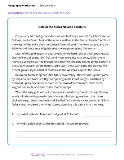
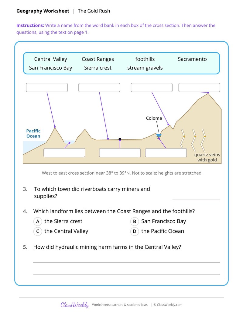
Most of it began in quartz veins in the Sierra Nevada. Rain, frost and rivers wore the rock away, and the heavy gold settled in stream gravels in the foothills, where miners washed it out with pans and sluices.
Ratings & Reviews
No reviews yet. Be the first to share what you think.
Reviews are for ClassWeekly members.
Make a Request
Spotted something to fix, or want a worksheet we don't have yet? Tell us and we'll make it.
Worksheet Details
| Grade | 8th Grade |
| Subject | Social Studies |
| Topic | Westward Expansion and Trails |
| Standard | D2.Geo.2.6-8 |
| Pages | 2 pages |
| Difficulty | Medium |
What is ClassWeekly?
ClassWeekly offers free worksheets and printable learning resources for kids, from preschool up. All worksheets are aligned to Common Core, NGSS, and C3 Framework standards and designed by educators. Become a member to access the full library and download unlimited PDFs.
Area Math for U.S. Land Acquisitions
The Mississippi River as the Highway of the West
The Jefferson Peace Medal as Evidence
Explorers of the American West, 1804 to 1846
Chinook Traders and the Corps of Discovery
The National Road and the Way West
Manifest Destiny Timeline, 1845 to 1854
The Sierra Nevada Foothills and the Gold Rush