Postcards From Five Cities
Written by Adi Ackerman, Head Teacher
"Postcards From Five Cities" is written for 2nd Grade (Ages 7-8). If your little one is a year younger but already steady on Maps, the page still works. You may just need to read the instructions out loud. And if they are older and major U.S. cities never quite stuck, this is a short review rather than busywork.
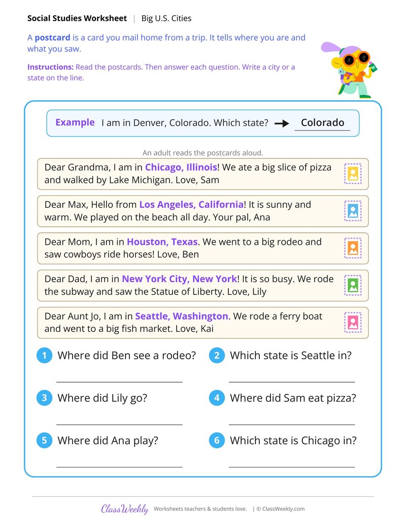
2nd grade social studies worksheet: listen to postcards from Chicago and Houston, then write the city or state that answers each one. Answer key included. Part of our major U.S. cities maps collection.
How do I use this worksheet?
Keep a U.S. map nearby so children can point to each city as they work. On the postcard and fact matching pages, read the boxes aloud first, then let children find the answers on their own.
What students will practice
- Students will listen to five postcards sent from big U.S. cities.
- Students will find details, such as where Ben saw a rodeo and where Sam ate pizza.
- Students will write a city or a state to answer each question.
Curriculum Links
Find this in the curriculum
Browse the grade, subject, and topic this belongs to.
FAQ
How do I use this major U.S. cities worksheet?
⌄
Keep a U.S. map nearby so children can point to each city as they work. On the postcard and fact matching pages, read the boxes aloud first, then let children find the answers on their own.
What does this worksheet teach?
⌄
Listen to postcards from Chicago and Houston, then write the city or state that answers each one. The directions on the page read: Read the postcards. Then answer each question. Write a city or a state on the line. The page opens with a worked example, and an answer key is included.
Can I use this major U.S. cities worksheet for homeschool or classroom?
⌄
Yes, both. We made it for 2nd Grade Maps, and the page works the same whether it lands on a kitchen table or a center rotation. At home, most families go through it together and talk the answers out loud, and that talking is where most of the learning happens with major U.S. cities. In class it runs well as independent work while you pull a small group. Print one copy or thirty, whichever the day needs.
Which U.S. cities do these worksheets cover?
⌄
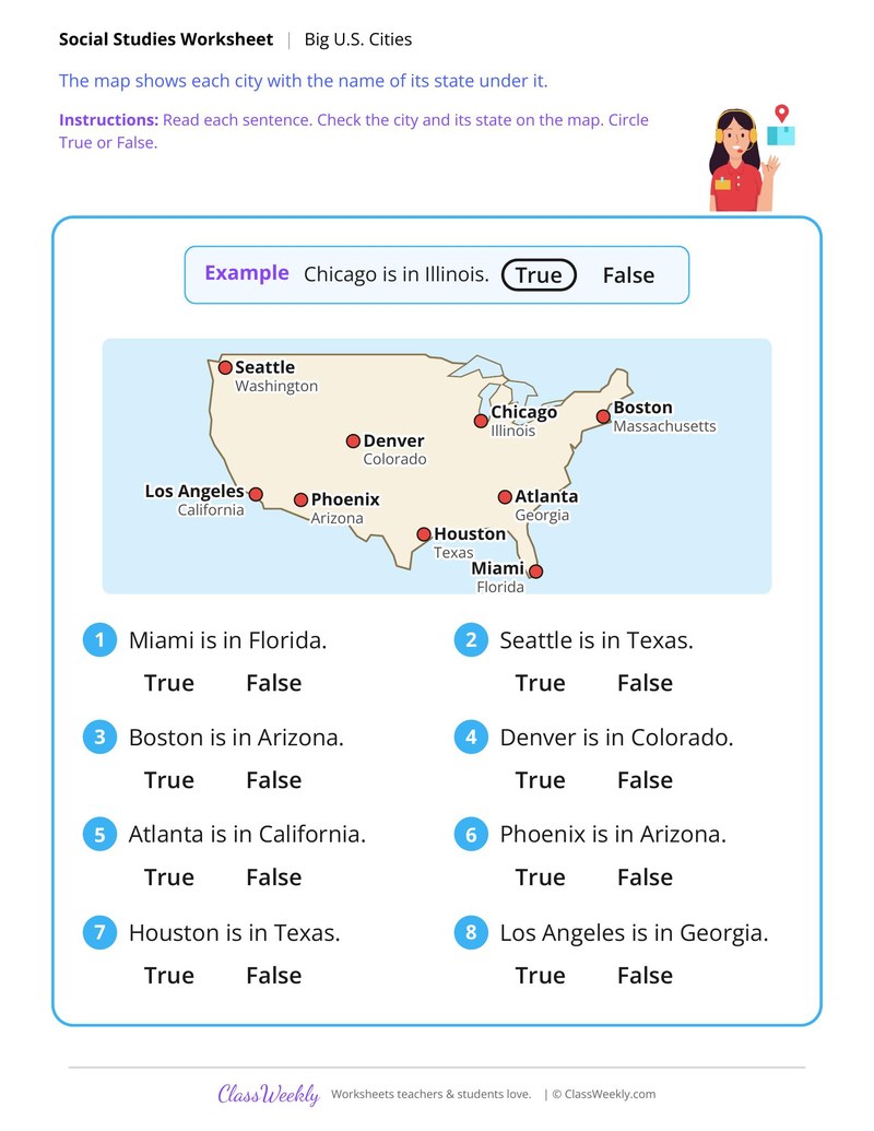
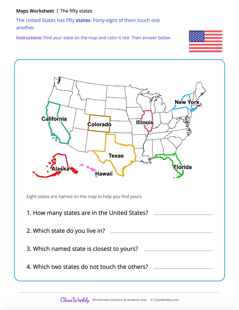
The maps show Seattle, Los Angeles, Denver, Houston, Chicago, Miami, Boston, New York City and Washington, D.C., and some add Phoenix, Atlanta, San Diego, San Francisco and Philadelphia. Each city is shown with its state.
What makes each big city famous?
⌄
On Match the City to Its Fact, Chicago sits on Lake Michigan, Houston has a big space center, Seattle gets lots of rain, Miami is near sunny beaches and New York City has the most people of any U.S. city.
How do children sort cities into West and East?
⌄
A dashed line splits the U.S. map. Cities on the left, like Seattle and Phoenix, go under West, and cities on the right, like Atlanta and Boston, go under East.
Ratings & Reviews
No reviews yet. Be the first to share what you think.
Reviews are for ClassWeekly members.
Make a Request
Spotted something to fix, or want a worksheet we don't have yet? Tell us and we'll make it.
Worksheet Details
| Grade | 2nd Grade |
| Subject | Social Studies |
| Topic | Maps |
| Pages | 1 page |
| Difficulty | Medium |
What is ClassWeekly?
ClassWeekly offers free worksheets and printable learning resources for kids, from preschool up. All worksheets are aligned to Common Core, NGSS, and C3 Framework standards and designed by educators. Become a member to access the full library and download unlimited PDFs.